
You could imagine my surprise as I awoke at 3:30AM on Friday morning, having expected rain and finding star-lit, clear skies instead.
"I couldn't possibly be THAT lucky..." I muttered, as I pulled up the radar on my phone and checked to be sure.
Nothing for hundreds of miles. Nothing to indicate the 70-90% precip chances, depending, that they'd nearly promised the last time I'd checked the forecast.
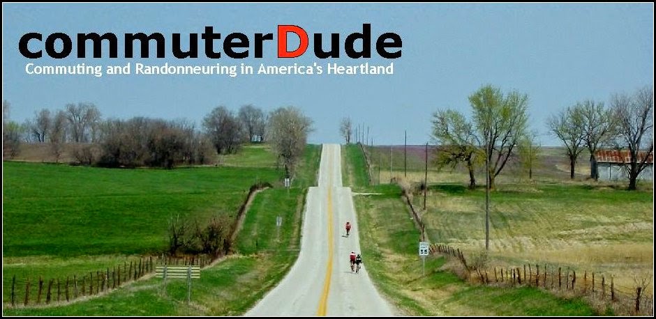
I hadn't ridden in the rain since April, and wasn't sure if I was mentally prepared for that level of "fun" - but, I still had the car packed up and ready for the journey back up to St. Joseph for this most-recent permanent ride. This time out, rain or not, the route would prove challenging. I knew it would be as such when the organizer, who normally rides the hills around St. Joseph on a fixed gear without complaint, mentioned this route probably had more climbing per mile than Bob's infamous Albany 300k. Yikes.
In retrospect, it wasn't over or under-sold: the estimation was spot-on. Just getting out of the St. Joseph city limits would prove interesting enough, and we wouldn't arrive at the real climbing for many more miles. Terry B. and Spencer K. and I rolled out of the start-line C-store and headed out of town, past the leftovers of the old Chicago, Burlington & Quincy RR bridge which used to cut right across where the gas pumps now stand at 28th and Messanie, and ultimately pointed our bikes east on Missouri highway 6.
Once free of the early morning work traffic on the eastern edge of St. Joe, the road opened up and took us out into the rural goodness of northern Missouri. As the miles stretched out ahead of us, the sun rose and confirmed the lack of clouds and storms. Still not convinced the weather service would have gotten it wrong to such a degree, I had brought the rain jacket along for this ride -- not so much worried about getting wet as getting cold with the passage of a significant cold front. Winds would be favorable, but they would eventually be from the north - and that, combined with rain, meant chillier conditions for sure. For the moment, however, I had put it out of my head.
Spencer and I chatted it up on route design and such, as I've got a couple routes in the hopper lately, and about life in general. Spencer would only be able to join us for the first 1/4 of the journey today, after coming off nearly 600km of riding in the week prior - but it was still nice to start with a group from the area, someone familiar with the roads at the very least. We stopped for a short break at Clarksdale, MO., at the roadside c-store there, and then turned east again for our first "lettered" highway of the day -- Route "O", running from Clarksdale to ....er, nothing. The route meanders a bit here and there to pass along the northern edge of the Pony Express Conservation Area -- the first of many preserves this ride would pass -- on its way toward Maysville, and the first control. At this point, with a smidgen over 34 miles covered, Spencer would leave us to pursue his own personal metric century recovery ride before returning home, so Terry and I would tackle the rest of the route as a two-some. It was a shame not to share the rest of the ride with him, but he'd done plenty for the week already! Bottles filled and bladders emptied, we pushed on.
The morning grew older and some of the humidity finally began to burn off - it hadn't been foggy, just very humid, and I was thankful to actually be able to see things more clearly. I have recently been suffering through one of my personal worst allergy seasons in memory - so, combined with the sweaty conditions and humid air, my eyes had already been watering uncontrollably since the DRIVE to St. Joe that morning. Terry and I pushed through the slight headwind on the way up Route "A" towards Fairport, and made the turn onto Route "E" - toward the first of the hillier sections of the day's journey.
Traffic dropped off - just as Spencer had foretold - and we descended into a deeper layer of rural farmland, hills, and unmatched scenery. The Santa Rosa area, in particular, stood apart as especially interesting - long unincorporated, the remains of the town sit huddled at the edge of the county line; the rich collection of old barns and buildings stood like overlords above the road, watching us as we rode through. With each mile, the hills came sooner, and steeper - even the few dogs we had encountered knew we had it bad enough, and barely bothered to give the usual chase. Spinning became pushing, which became standing and grunting... but the scenery atop each rise proved worthy of the effort required to get there. Still, the density of climbing found me stopping for the occasional photo-op... which is code for "I was tired."
Onto the 400K route, US-69 highway, northbound... after finally answering a question I had asked of myself each time I'd ridden north on the 400K route at about this exact point... "wonder where that highways goes?" ... now I know, and yeesh... don't make a wrong turn!
"you may ask yourself... where does that highway go to?" -- David Byrne, Talking Heads
With the headwind increasing by the hour, Terry and I were deep into it, now. Pattonsburg was still a dozen miles away (?), and I quickly recalled this being THE 400k's section which usually rendered me very pleased to reach the first control there. It was gradually uphill, and the wind just made it all the more difficult to find a good rhythm... however, we made a good clip, making it to the turn on highway "C" quicker than I'd expected... if not a little worse for the wear. That last bump up to the intersection leading towards the new town always reminds me that nothing around here is REALLY flat. At the control, it's a quick in-n-out routine, as Terry and I both had plans to hit the Old Memories Cafe nearby, instead of hanging out at the gas station... a nice change for me, and something I don't usually attempt. Controls, for me, create something of a timewarp on the best of days, and catch me not paying close enough attention I can get behind the clock and in trouble in a hurry. This time out, Terry and I had plenty of time in the bank, so a quick sit-down meal wouldn't create a problem.
Burger and chips for Terry, and something a little sweeter for me: apple pie and chocolate milk. The day before this ride, I'd taken a trip up to Weston, MO. with my coworkers on a little day trip for a team builder, and at the end we'd ended up at O'Malley's, where I enjoyed the weird combination (yet, somehow, extremely tasty) of a pint of ale and a slice of warm apple pie ala-mode. I was fairly confident, at the time, that another slice of apple pie during the ride would act as rocket fuel for the advertised "pretty hilly" section that was to come after the Pattonsburg control - so it seemed like a great idea! Pie, up!.... on occasion, we still do ride to eat... plates cleaned, glasses cleaned, bottles topped off - and legs a little cold from the extended sit - we paid up (Thanks, Terry!!) and headed back out to the waiting bicycles to mount up for the 'tough bit."
The southbound, downhill pitched section of US-69 heading out of "New" Pattonsburg and down the hill to "Old" Pattonsburg was a tailwind-fueled thrill-ride! I should, first, explain the significance of that statement, for those not familiar. Though I can likely point you here or here[1] and call it "good", it's a short story. The original town site suffered from frequent flooding over the years (33 times since 1900 [1]), and the flood of 1993 proved to be the last straw. A new town site was established a few miles to the north on the opposite side of US-69 highway, and - most importantly - farther up the hill in elevation from the nearby Grand River and Big Creek, which meet very close to the old town site. Having this information on board and riding in the area, over the many bridges and washouts, it becomes very apparent... this old town was LOW, and surrounded by water. Upon reaching the turn at highway "Z" we began to roll past many old structures and a lot of local history. Apparently, some amount of business and activity still occurs at the old site, but it sits mostly abandoned. The original streets in horrible repair - and Terry and I anxious to get the hills over with to the west - I didn't do a lot of exploring... but it was awfully inviting. For me, it wrapped up a couple of days of seeing some really neat, old structures - inside and out - in various parts of the state.
The title of this route - Ride with the Devil - comes from Pattonsburg's unique history: after the new townsite had been established, the old town ended up being re-touched and used as a stand-in for late 1800's Lawrence, KS. for the Ang Lee Directed film "Ride with the Devil"... so, it seemed an apt title for the route itself. Spencer had certainly put together a "devilish" ride, considering all the climbing.
Highway Z... what can I say about that road? I had started up this little weekly/monthly thing on my Twitter page... the habit never caught on... called "Road of the Week", where I'd toss out remarkable sections of road, either especially challenging, or just really well-paved, to start the mind wandering. This road would make the list... probably topping it for all time. It's not the best pavement, doesn't have the most remarkable scenery... and in some places, it kinda smells funny if the wind is "right" because of nearby corporate farming. But, the hills... oh my gosh, the hills. This highway sits on a few miles of the Albany 300km route, and I always remembered it being tough... yet, I'd never ridden the full length of it, like we would today - and a lot of it remained unknown to me. The section out of Pattonsburg is flat as it works its way west and out of the floodplain in which the old town rests. After a few miles of dodging chuckholes (the road is still a victim of frequent high-water situations, clearly) the pavement eventually improves and the first of the hills begin to pitch upward. After that, the land spreads out, the trees thin, and the rolling countryside invites rider's eyes to gaze far off into the distance. The recent rains had greened up everything, and the wildflowers (sometimes painting entire hillsides) shouted color into the afternoon sky... mild distractions from the mounting elevation changes. Down.... up.... down.... the old "10-40" routine started: Ten MPH on the way up...if that....and a gravity-assisted rush up to 40 MPH on the backside... repeat. For miles....
Twenty-four miles to be exact... and at times, it truly seemed like this section was far, far longer. I finally breathed a little easier coming to a landmark with which I've become familiar with over the years - the intersection of highways "A" and "Z" in rural Gentry County... one of my favorite photo-stops, mainly because - once upon a time - W0DEW snapped a photo of me and the Warbird rifling our way north on what would be my first 300km finish. Ever since then, every time I ride through that intersection, I stop and take a new photo from the same vantage point. Tradition... and a great way to demonstrate that nearly NOTHING has changed up here in, certainly, the last 10 years... and possibly the last 50. Today would be no exception, as I stopped, dismounted and snapped a couple photos - and uploaded them (something that's only recently become possible, thanks to a new, nearby cell tower). A quick nature call, and back on the bike, right as Terry caught me up.
More hills, but, at least I knew the area now. The pie in my gut - possibly the chocolate milk - put up a bit of a fight as I attempted to make quick work of the climbs... typical indigestion and lead-gut followed, answering my questions about whether or not a slice of pie was REALLY a good idea or not. I need to stick to the french fries, next time. We rolled towards the monsters that crawl through Berlin, MO., past the always interesting animal farm there. Over the years, Berlin's farm has hosted a number of the usual farm suspects, but this time I saw donkeys, goats, sheep, and perhaps a couple alpacas - all running along the fence as I pedaled past. At least, for a few moments, it took my mind off the climbing.... oh, lets be serious: I prefer the climbing... but, MAN... I was proving to myself again that since moving to the formerly pan-flat ex-farmlands of Olathe, KS., I was a bit out of practice. The hills continued for another 3 miles or so until I reached the intersection of highway H... where I'd normally turn south to follow the old 300k route. This time, I'd head straight toward what I can clearly recall is a hill I'd always comment upon, while riding that 300k... "at least I don't have to climb THAT!" Normally, I'd turn south... but, today, however... yes, yes I did have to climb it.
Wow.
And the "wow" factor would continue, as I quickly learned that the section between "H" and "A" via Berlin, MO., was quite possibly "the easy part." With each passing mile, and each newly-discovered hill, I marveled at how much steeper and longer they could become. The final miles to King City, and the next control, seemed to take an eternity. I remember passing a "King City - 3 miles" sign at one point, but then wondering "how long ARE these three miles??" after the hills just seemed to keep coming, and reaching the top revealed only more still to climb. I stopped again for another photo-op (ok, tired again) when the King City wind-farm had come into view.. and rest-required or not, it was still a remarkable sight from the seat of a bicycle. I continued farther still, towards King City.... which still seemed to never come (until it did, of course) --- this must be ROUGH going in the winter months for the locals. Finally inside the city limits, and closing in on the inevitable Casey's General Store - the haven of the randonneur - it was time for another signature on the card, and more fuel for the increasingly tired legs. Whoof... THAT was a hard section. I imagined the Border Patrol route: its four good hills between La Cygne and Pleasanton are scattered across 25 miles of gently rolling terrain. This last section of THIS route was 25 miles of SOLID hill after hill after hill. Yeah, I love it... but, man... one has to work at it. I give out gigantic props to the St Joseph cycling clubs that normally come out on these roads for a good day's training; it was making sense why most northland cyclists are strong, strong riders. These were the proving grounds!
After refilling and refreshing at King City, it was time for the last leg of our journey... but, as the north wind and the leaden skies foretold, the sunshine and "weather service" oversight were not to last for much longer. I even became bold enough, after talking myself out of it for hours and hour, to pull up the radar image on my phone to see just what was held in store for us over the last 30 miles of the ride. There it was... a nice wall of greens and yellows headed towards our area from the west. Ah well -- at least I would be justified for hauling the rain jacket along for the entire ride, thus far. It wasn't time quite yet, though. Terry and I prepared, and headed out of town on the extension of the same piece of pavement headed west -- though now, it was no longer signed highway "Z", but Missouri 48. Possibly in keeping with the nature of a State highway, the grades softened and the pavement quality improved greatly as we moved toward the old, unincorporated Whitesville, MO. area. On our way, however, near routes "P" and "M", the first heavy drops hit the pavement... so, Terry and I pulled over to prepare for the coming rain, which had finally greeted us.
Yeah, I don't now why, now -- but I had been a little nervous about the weather. I hadn't had a rain ride since April, and I didn't have a clue how the new type of tire I'd been running would behave in the wet. Still, my trusted rain jacket, fenders... there was no reason to be timid about the rain coming. There would be no hail, no chance of severe weather remained in the forecast... so, though rain did eventually fall, I was pleased the forecast hadn't played out as originally written.
We made it through the Whitesville area, amid more scenic barns and old farm homes, and turned southbound on highway "D", after crossing the Platte River on a terrific old bridge; a bridge that came as an utter surprise, as many of the type had long been removed as part of Missouri's "Safe and Sound" program. Come to think of it, there is another good one on the "Mere Two-Hundred" route, a bit to the south... but, at the time I'd thought THAT bridge was a rarity... two in the same general area? Nice! Approaching the Happy Holler (no kidding) conservation area, the hills came back into the picture. Perhaps it was the tailwind, or the gentle and steady rainfall (and my realization that my tires were just fine, after all), but the hills didn't seem as severe as highway "Z"... but, I was fooling myself. They were just as steep - arguably moreso - but, with only a couple dozen miles left to go, I was feeling fine. Terry's comment, however, about how lucky we'd been to have a tailwind for this section echoed in my head.... on a typical summer day, a strong south wind should have been present. If it had been, goodness: this section would have taken a much more dire theme. Instead, the scenery spread out - breathtaking - and the rain brought a hush to the air. Occasionally a bird or two would break into song, enjoying the downpour. Traffic fell off completely, at least for a little while before we began to approach the outskirts of Savannah and other smaller towns scattered about, right about the time area schools had begun to let out.
The last few miles were something of an enigma - every time I thought for sure, as I rolled down this unknown road with Terry, that the road was going to finally level-off, another giant hill would appear ahead, and same as I'd seen on highway "Z", they'd be steeper in appearance each time. Still, out there, in the rain, good pavement and manageable traffic -- who could complain? It's excellent country up there, north of St. Joseph... and I was loving it, having survived the worst of the hills, and looked forward to a quick stop at Avenue City.
We arrived at the intersection of "D" and US-169 and Route "W", and the Avenue City store. I chuckled to myself... I hadn't ever been to this store DRY. Perhaps next month I'd give it a shot.
Water, fuel, and an assessment of layer and consideration of the rain - which seemed to be stopping - and we rolled off onto the last 10 miles or so of the ride.
As well rolled along, indeed, the rain came to a stop and the sun began to peek back through the passing clouds. Being so close to the finish, as much as I wanted to stop and shed the rain jacket I simply kept moving. We'd be back at the parking lot soon enough. Before then, however, a little traffic dodging and hill climbing to get back into the St Joe core lay in order. Ugh... I guess I saved just enough in the reserve tank for the stoplight dashes and steady climbing through the outskirts of town, as we headed back towards the Missouri River. Finally back on 28th Street, and then back to Messanie -- DONE.
In more ways than one... done. What a day! For a few moments, a frowned at the average speed, which had fallen to just 15.0 MPH by the end... something in the mid 16's by the halfway, if I recall correctly. With the "ridiculous" amount of climbing, the crosswind, the fatigue, the rain...the pie, the chocolate milk... so many variables. It'd certainly been a near 10-hour finish had it not been for the photo stops and the sit-down meal... but, right there, I miss the whole point. I had an excellent time, and excellent day out... and being in a hurry, hammering harder... somehow that would have changed the flavor a little. I'm still keen to try and best the overall average of my last R-12 run... but, maybe, somewhere in all this, I don't? Easy to say... I know that my climbing game is off... but, again... I'm not sure that's the point of all this. I can always come back, and try to tame highway "Z"... I like that process... but only if it's FUN. I had fun today. Getting down on myself that I wasn't "as fast" as I'd really wanted to be... that's unfair to the whole scale of the ride. I'm pleased enough that I'd managed to ride the entire route without getting any chain lube onto my 27-tooth bailout cog on the rear cassette. That, for today, is victory enough.
Also, this marks my 50th certified RUSA ride of 200K or above! Though these pages might paint a tale of having ridden far more than that number suggests, I'm still pretty jazzed about it. Here's to another 50, eh? With excellent company, the best scenery I can remember, some soothing rain - instead of near-heatstroke conditions, after the summer we've had - and the satisfaction of tackling an especially tough route, I can't think of a better way to spend a day, nor a better day to mark "the 50th" rando-ride.
Songs in my Head:
This time out, I genuinely stuck to songs in my head -- as opposed to in my headphones.
Not sure if it was the rain chance, or that I just wanted to make sure that I wasn't becoming too insistent on using the MP3 player as a crutch - but, I'd left it in the seatbag the entire ride. The result added a couple new songs to my playlist - songs which just popped into my head, a couple I hadn't heard in years. I always find that phenomenon interesting, and the MP3 player can stand in the way of that process. So, since I managed to entertain myself in that fashion this time, I didn't need to bust out the earphone.
Not a big list... but, I was busy climbing.
Nutrition:
More of the same from last time, but the controls sat more evenly-spaced, so I never ran into a shortage. CarboGain powder, one serving per bottle plus the GU electrolyte tabs for flavor; worked perfectly again. The only real difficulty I experienced came after the pie and chocolate milk -- though I'm not sure which one had been responsible (or if it was the combination) for the lethargy and rock in my gut after Pattonsburg. I guess I need to just stick with all liquid to avoid this issue... or perhaps just stick to items without sugar... as I type that out, it occurs to me that the sudden dose of sugar may well be the real issue here. I still managed the hills, of course - but, like I'd mentioned earlier, a plate of french fries wouldn't have put up quite such a struggle: something to test for next time.
Thanks for reading, as always!
Stay tuned... October is next...
1 comment:
Glad you liked the route. It is a wonderful route that has kicked my ass many a time.
The pleasure of the finish changes when you have a nasty 20+ mph south wind.
Oh well, I am glad you enjoyed the day. Thanks for coming up north to ride with us.
-Spencer
Post a Comment